

360 DRONE PHOTOGRAPHY
360 Drone Photography Toronto
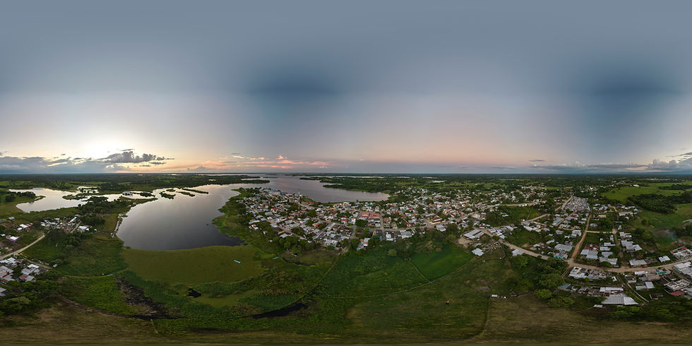
Bring your project, property, or event to life with immersive 360° drone photography. Our advanced drone technology captures fully interactive, panoramic views—perfect for real estate, architecture, construction, tourism, and marketing. Showcase spaces with dynamic, high-resolution visuals that allow viewers to explore every angle remotely. Whether you're creating virtual tours, marketing content, or detailed site documentation, our 360 drone services deliver an engaging and elevated experience.


Why Choose Our 360 Drone Photography Services?
✔ Immersive 360° Views – Let viewers explore your space from every angle with fully interactive, panoramic aerial photography.
✔ High-Resolution Quality – We deliver sharp, detailed imagery that enhances virtual tours, marketing materials, and presentations.
✔ Engaging & Interactive Content – Perfect for real estate, tourism, architecture, and event promotions—create experiences that stand out.
✔ Custom-Captured for Your Needs – Whether it’s a commercial property, construction site, or scenic location, we tailor every shoot to your goals.
✔ Licensed & Insured Pilots – Our certified drone operators ensure every flight is safe, legal, and professionally executed across Toronto.
Bring your vision to life—book your 360 drone shoot today.
Capture Every Angle with 360 Drone Photography in Toronto
Immerse your audience in a full aerial experience with our 360 drone photography services. Perfect for real estate, tourism, architecture, and event marketing, we create interactive, panoramic visuals that showcase every detail of your space from above. Whether you're highlighting a property, promoting a location, or offering a virtual tour, our 360 solutions help you stand out, engage viewers, and tell a more dynamic story.

OUR SERVICES

Drone Photography
and Video
Drone photography and video are excellent tools for construction progress monitoring. With high-resolution images and videos, you can easily track the progress of your construction project and identify any potential issues. Contact us today to learn more about we can help you with your construction progress monitoring needs.

Drone Mapping
Drone mapping and orthomosaic photography are powerful tools for capturing high-resolution aerial images and creating detailed maps. With the ability to cover large areas quickly and accurately, these technologies are revolutionizing industries such as agriculture, construction, and surveying. Whether you're looking to improve crop yields, monitor construction progress, or map out a new development, drone mapping and orthomosaic photography can provide the data you need to make informed decisions.

Thermal Imaging
Drone thermal imaging is a cutting-edge technology that allows you to capture high-quality thermal images from the air. With this technology, you can detect heat signatures and temperature changes that are invisible to naked eye. Whether you're inspecting buildings, monitoring crops, or conducting search and rescue operations, drone thermal imaging can provide you with valuable insights and data. Contact us today to learn more about how drone thermal imaging can benefit your business.

ABOUT US
Toronto Drone Photography is a technology company specializing in providing our clients with advanced drone services. Our drone photography expert team has years of drone piloting experience and is committed to delivering high-quality results. We can help you monitor and track progress on your construction projects with drone mapping technology.
2013
Year Established
1000+
A+
Flights Completed
Advanced Drone Pilots
OUR WORK


OUR CLIENTS


CONTACT US
Get in Touch
For any inquiries or questions, please call us at 647-242-2743 or fill out the form below.
Get a Quote
Tell us about your project, and we'll happily assemble a customized package.
Contact Form
